On May 10, 2024, shortly after 17:00 UTC, a historic geomagnetic storm arrived at Earth. This storm was the result of five coronal mass ejections (CMEs), which are large explosions of charged particles and magnetic fields lifting off from the Sun’s surface. Arriving at Earth, these CMEs combined to create a storm that drove brilliant auroras visible across the continental United States and as far south as northern India.
Initial analysis shows that this was a 1-in-20 year event rivaling the great geomagnetic storms on Halloween of 2003, according to Assistant Professor Dan Welling, at the U-M Department of Climate and Space Sciences and Engineering. Similar to the Halloween Storm, this space weather event had impacts on technological systems around the world, but those hazards were treated with a far superior system of forecasts, warnings, and responses.
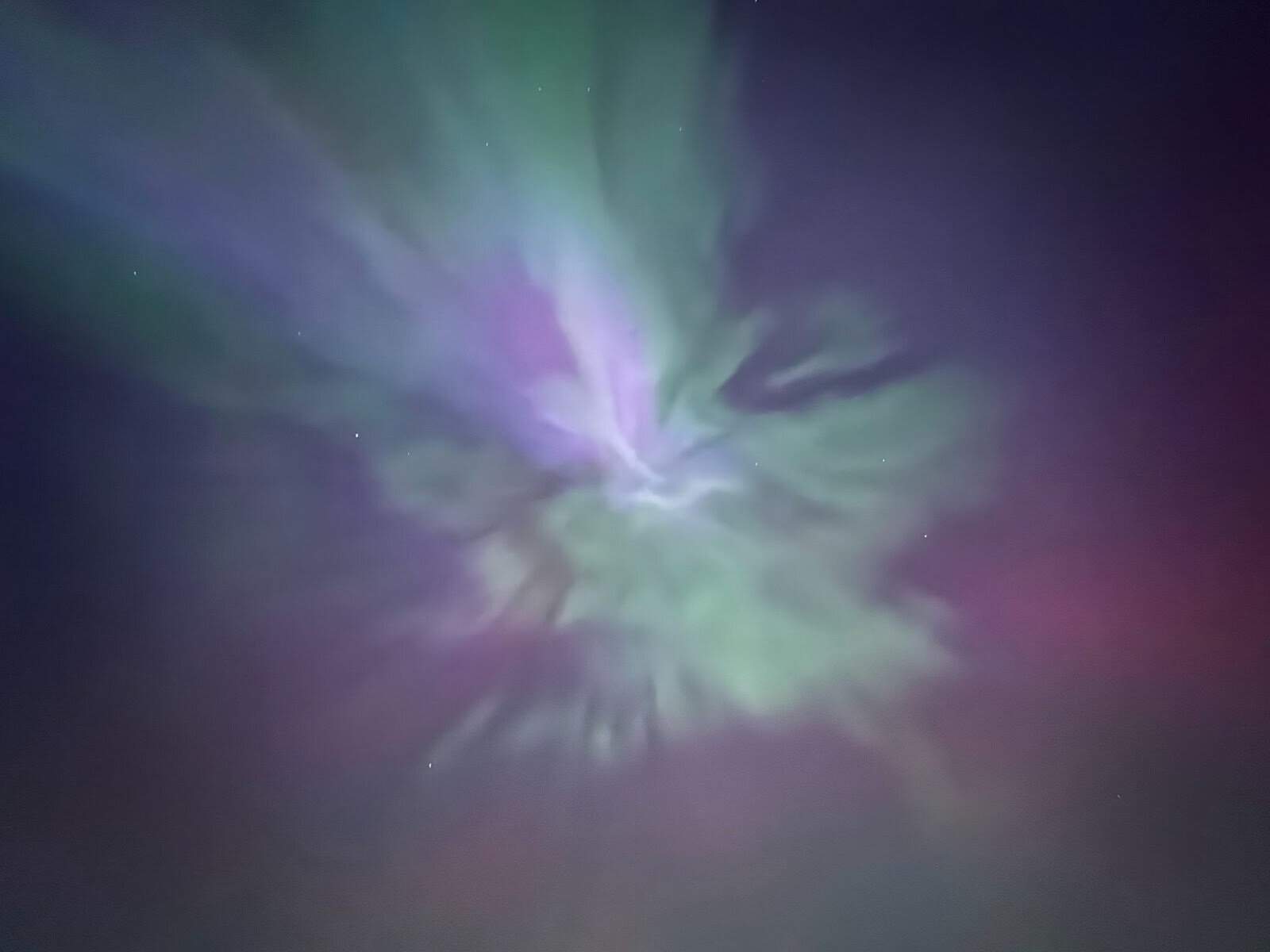
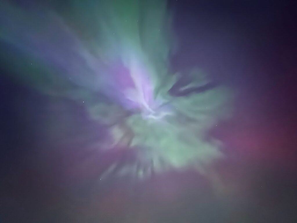
Aurora as viewed from Ann Arbor, Michigan. Photo taken by Xiaoye Zhu.
NOAA’s Space Weather Prediction Center (SWPC) was able to provide ample warning of the storm and its scale. For the first time in 20 years, a “G4 Storm” — the second strongest on the G-scale of geomagnetic activity — was predicted by SWPC*. This warning turned out to be both accurate and timely, preceding the arrival of the event by 24 hours. Subsequently, SWPC was able to provide advanced warning of the arrival of the storm** with subsequent alerts as the high G-scale thresholds were crossed.
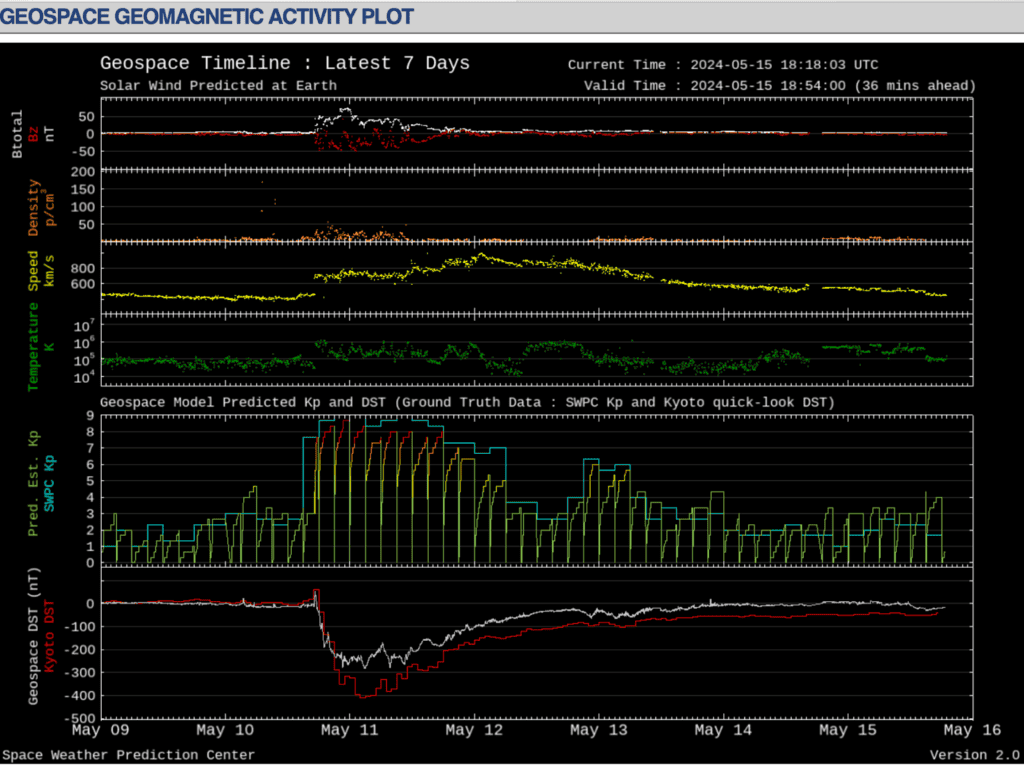
A key tool used to aid SWPC’s warning and alert system is the Michigan Geospace model – a numerical model of the space environment that gives short lead time forecasts of geospace storms. The Geospace model is a specific configuration of the University of Michigan’s Space Weather Modeling Framework, which was transitioned to operations in 2016 and updated multiple times since then. During the May 10th event, the Geospace model accurately predicted two key indexes of the global storm strength: Kp and Dst. Further, it provided localized information on what regions were likely to experience strong geomagnetic disturbances (GMDs). With the help of the SWMF/Geospace model, SWPC was able to issue an alert that the storm was about to begin.
The Michigan Geospace model accurately forecasted the intensity of the storm. The top four panels show the solar wind and magnetic field measured by the ACE satellite. The bottom two frames show the measured Kp (light blue line) and Dst (red line) indexes together with the corresponding model predictions. Image taken from the NOAA SWPC website.
While there were widespread reports of space weather impacts on technological systems, the increased readiness and capabilities of SWPC and other institutions around the world prevented any long-lasting impacts. Trans-polar flights were rerouted to lower latitudes to avoid increased radiation hazards. GPS signals experienced severe interference, affecting satellite-guided farming equipment. The ISS crew took shelter to protect against harmful radiation exposure. Despite initial reports of power grid irregularities, no outages occurred. Transpower, New Zealand’s sole power grid operator, acted on the SWPC forecasts by entering a grid configuration resilient to space weather effects. Utility companies across the United States halted field work to protect their workers. These impacts pale in comparison to those of the Halloween 2003 storm, where severe power grid impacts caused blackouts in Sweden and South Africa.
That the storm did not disrupt the daily life of people around the world is a testament to the advances made in space situational awareness. The growing partnership between NOAA SWPC, NASA, academic and commercial research organizations, and industry stakeholders has grown the space weather enterprise and our resiliency to geomagnetic storms. The University of Michigan continues to play a critical role in these developments, from developing computer models used in operations, advising national boards on how to improve mitigation strategies, and leading the research to understand the physics behind these storms.
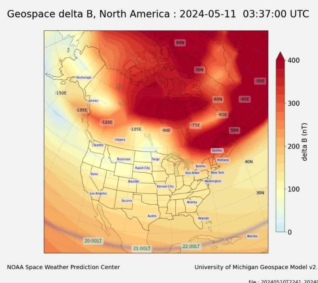
Regional forecast of geomagnetic disturbances produced by the Michigan Geospace model running at NOAA’s Space Weather Prediction Center. Image taken from the SWPC website.